|
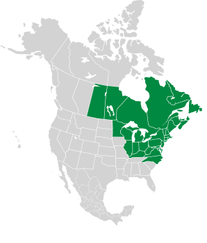
Aralia hispida Vent. Bristly sarsaparilla
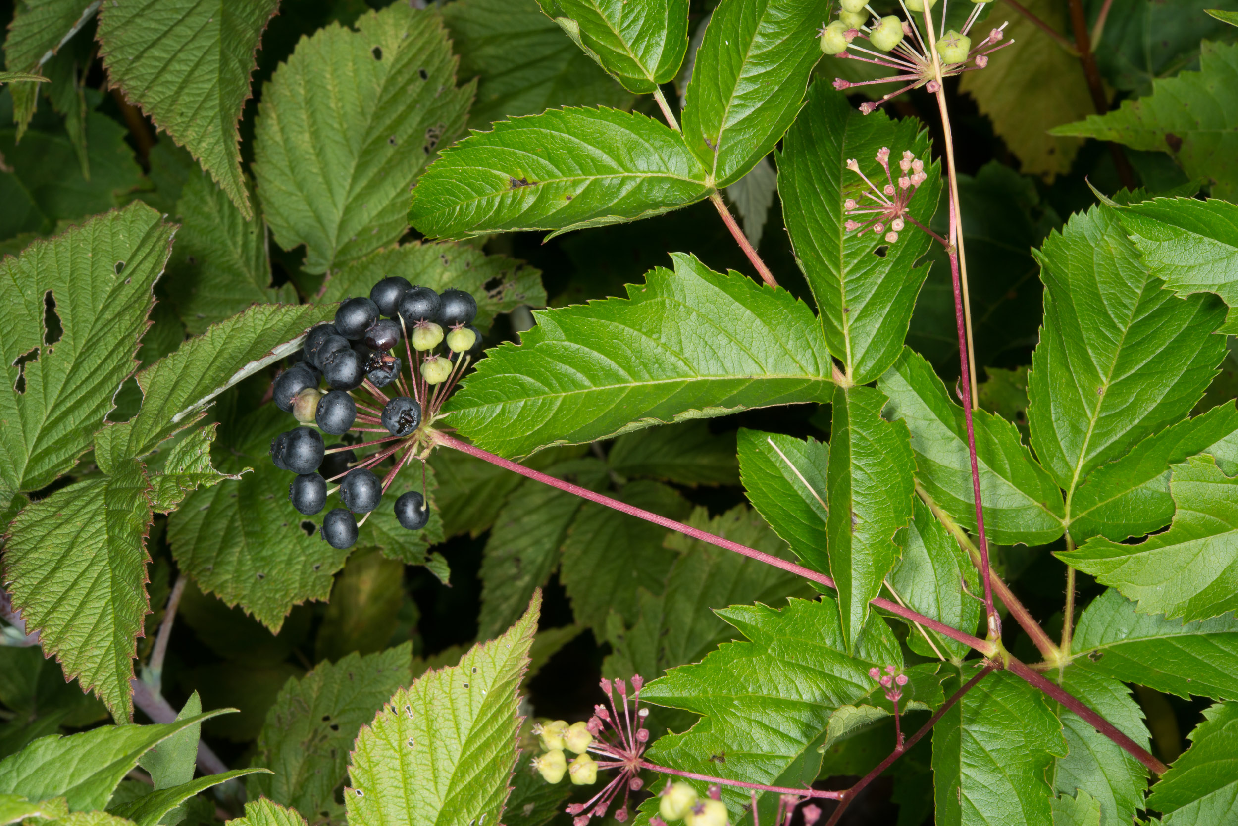
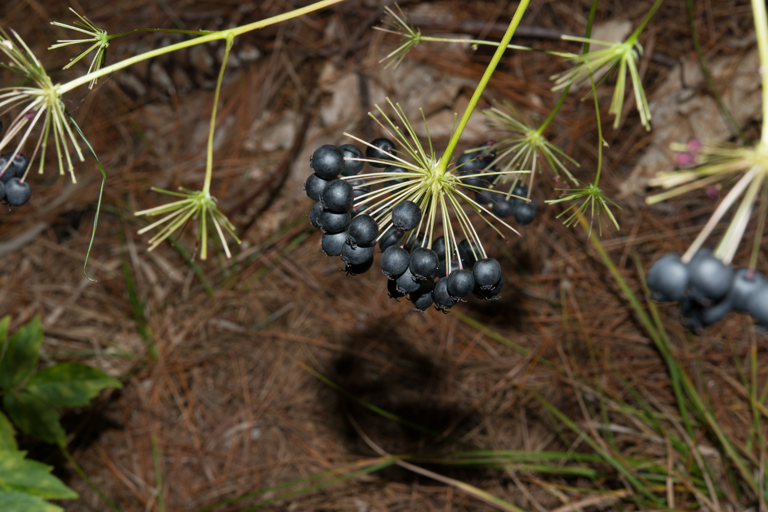
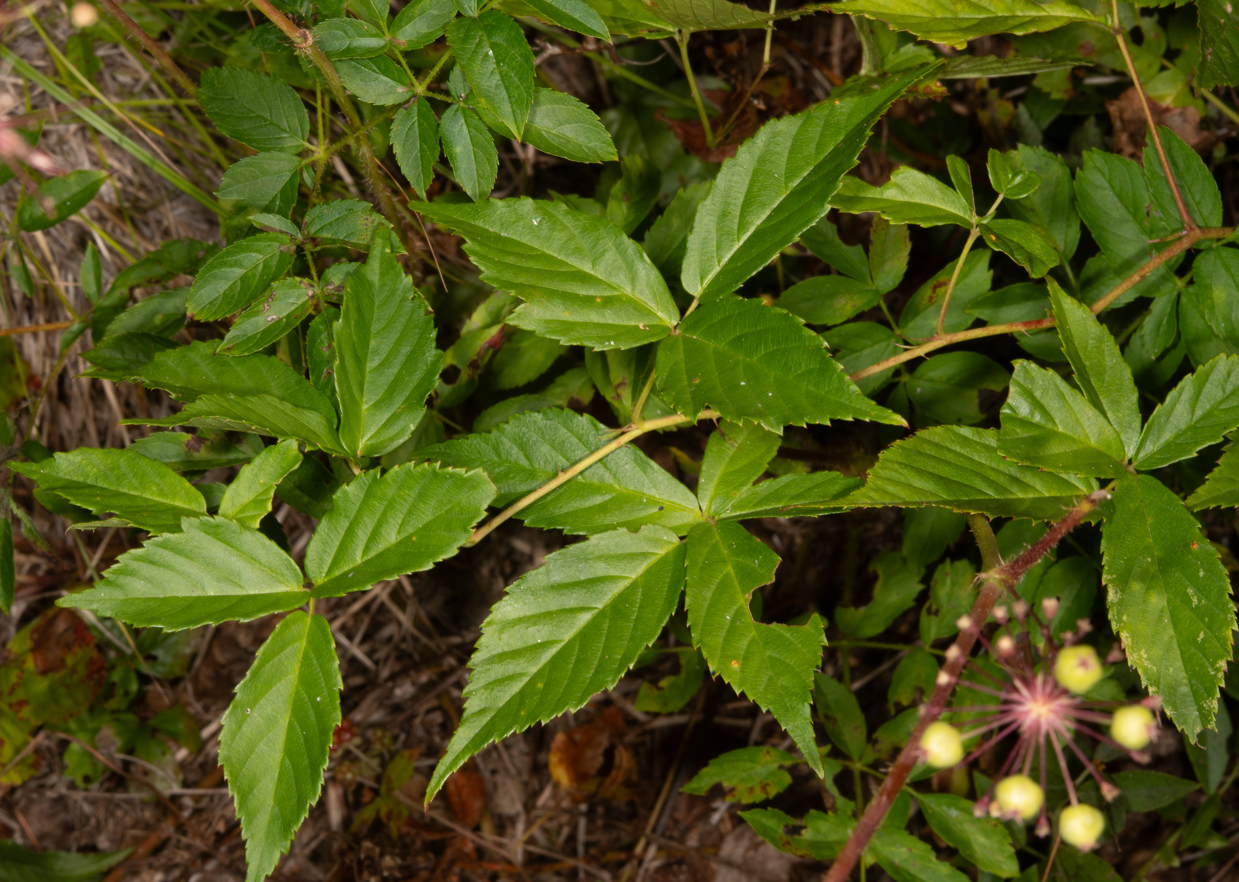
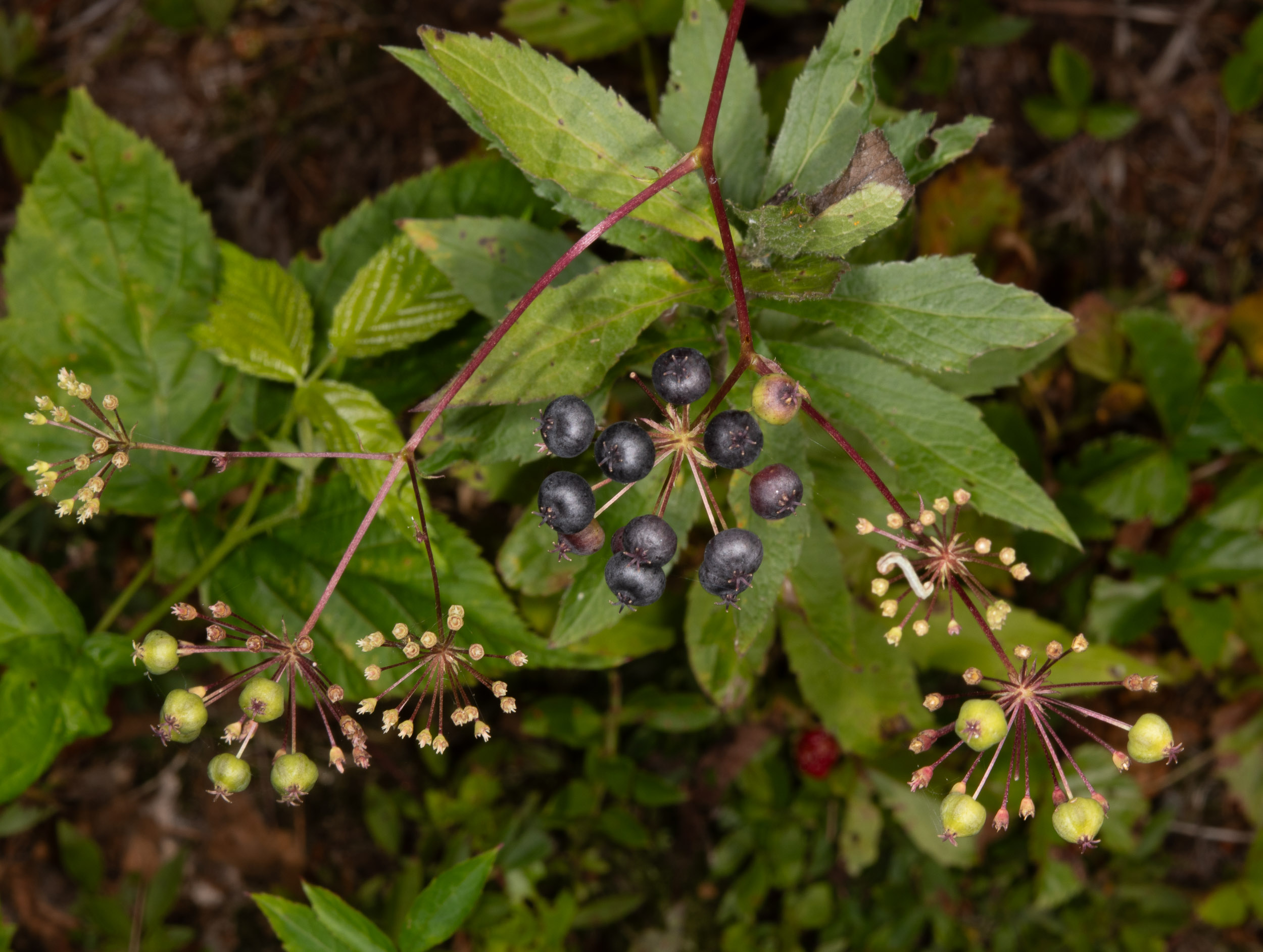
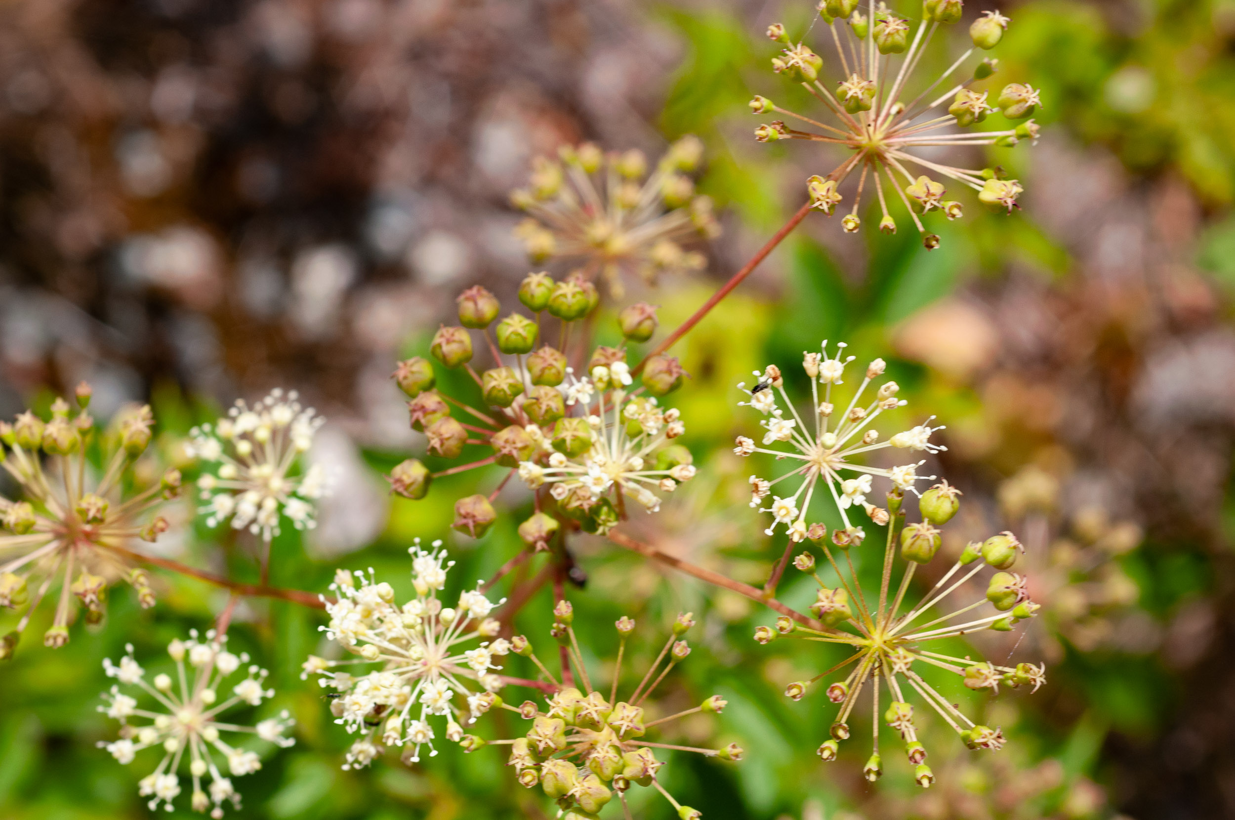
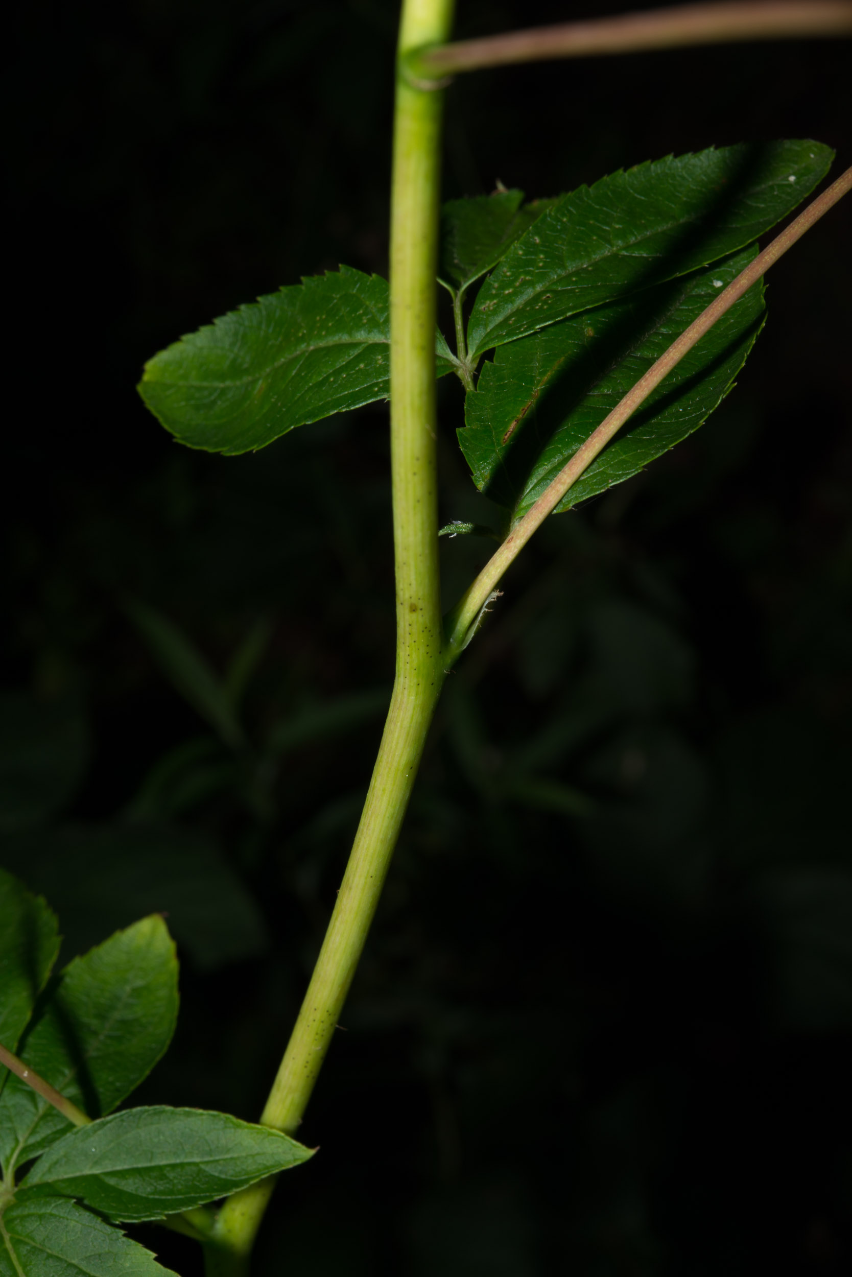
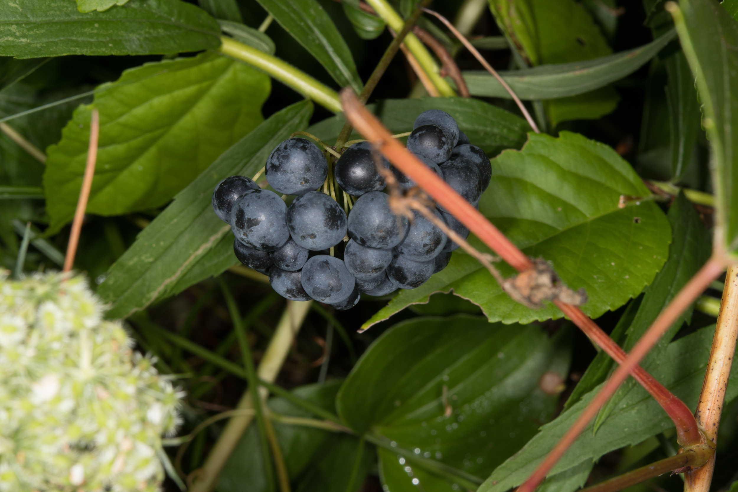
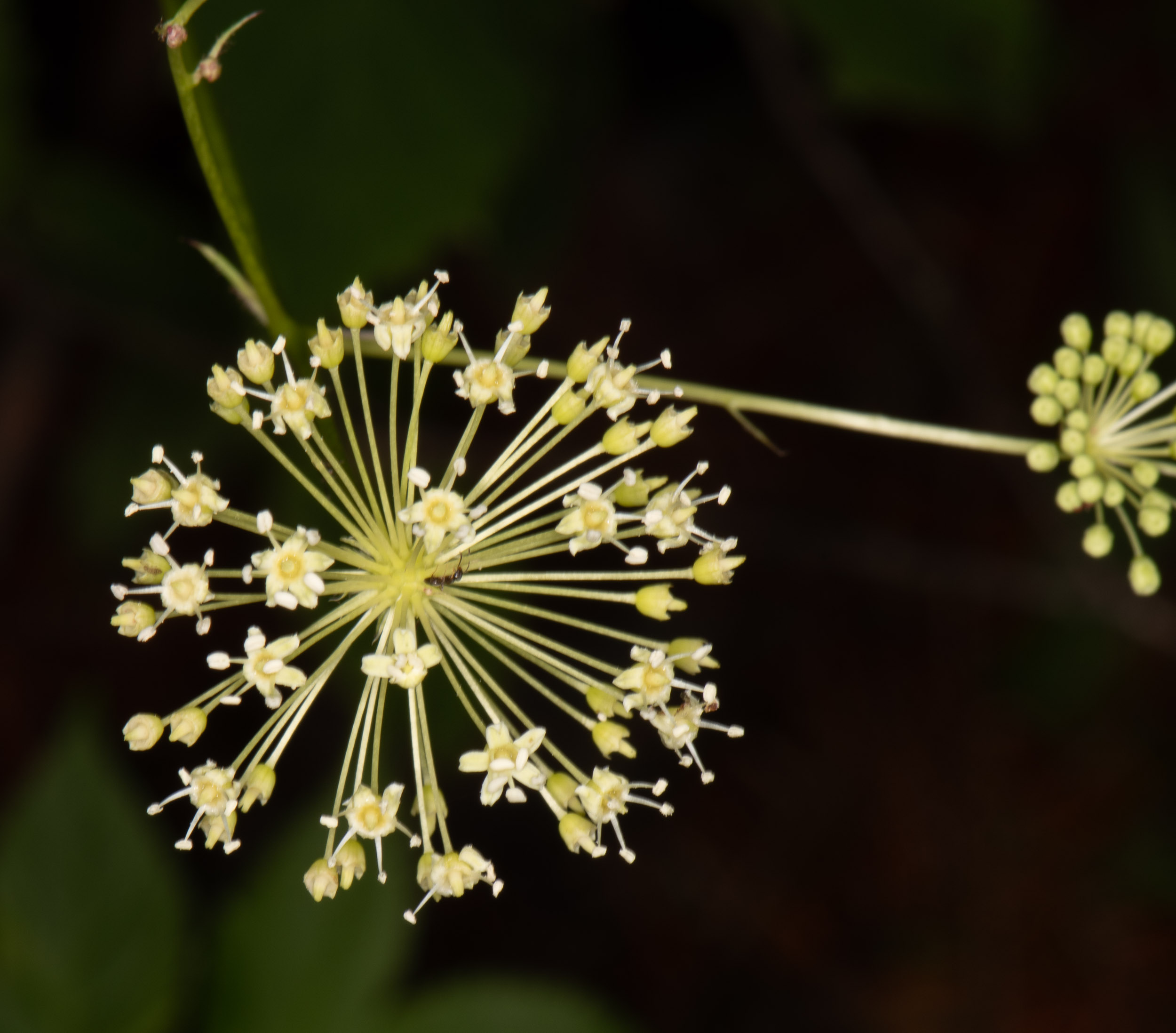
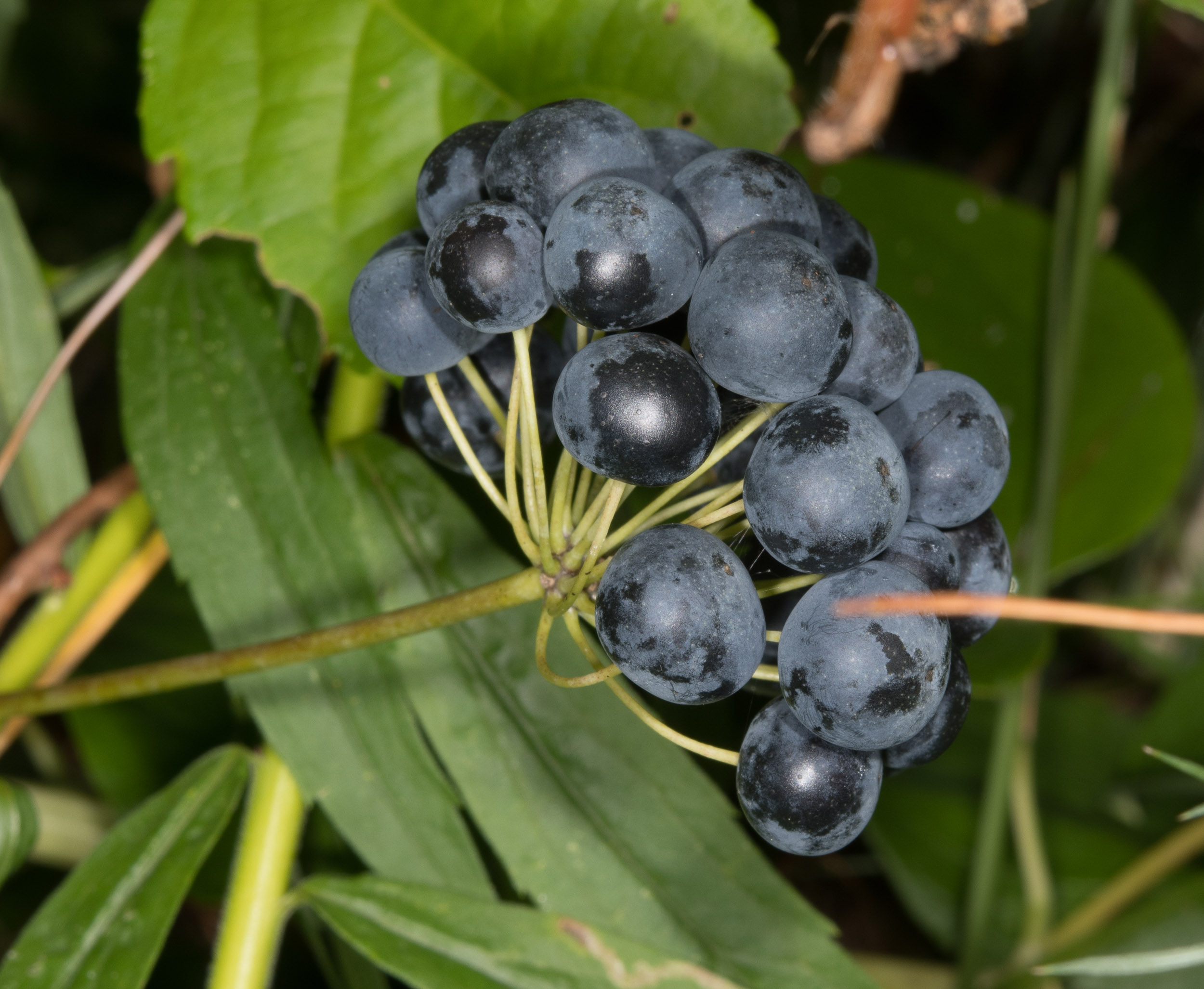
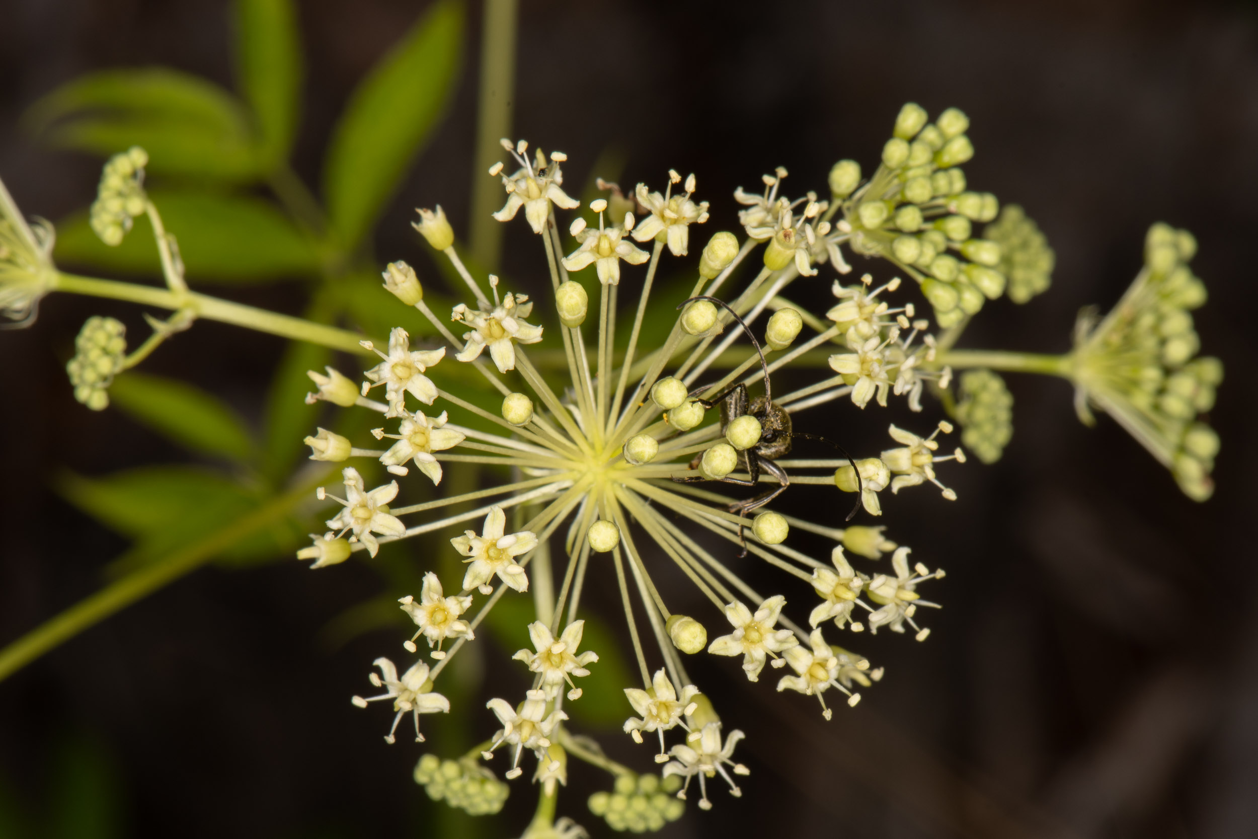
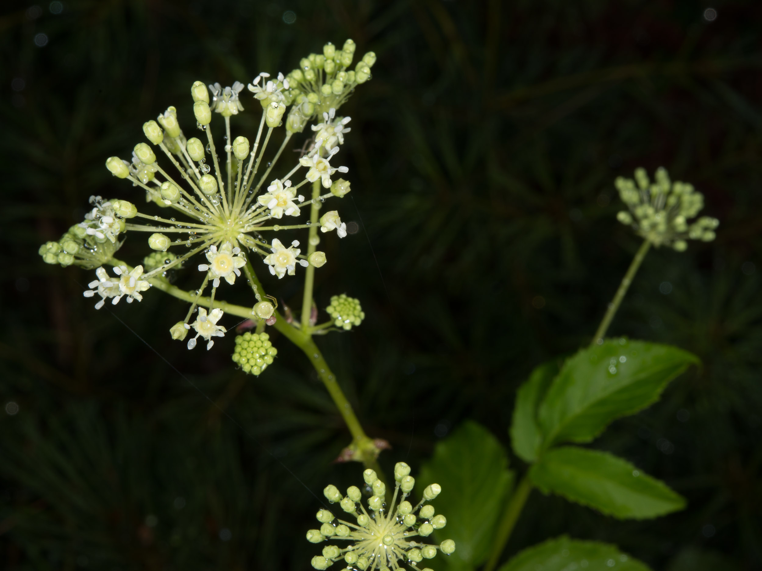
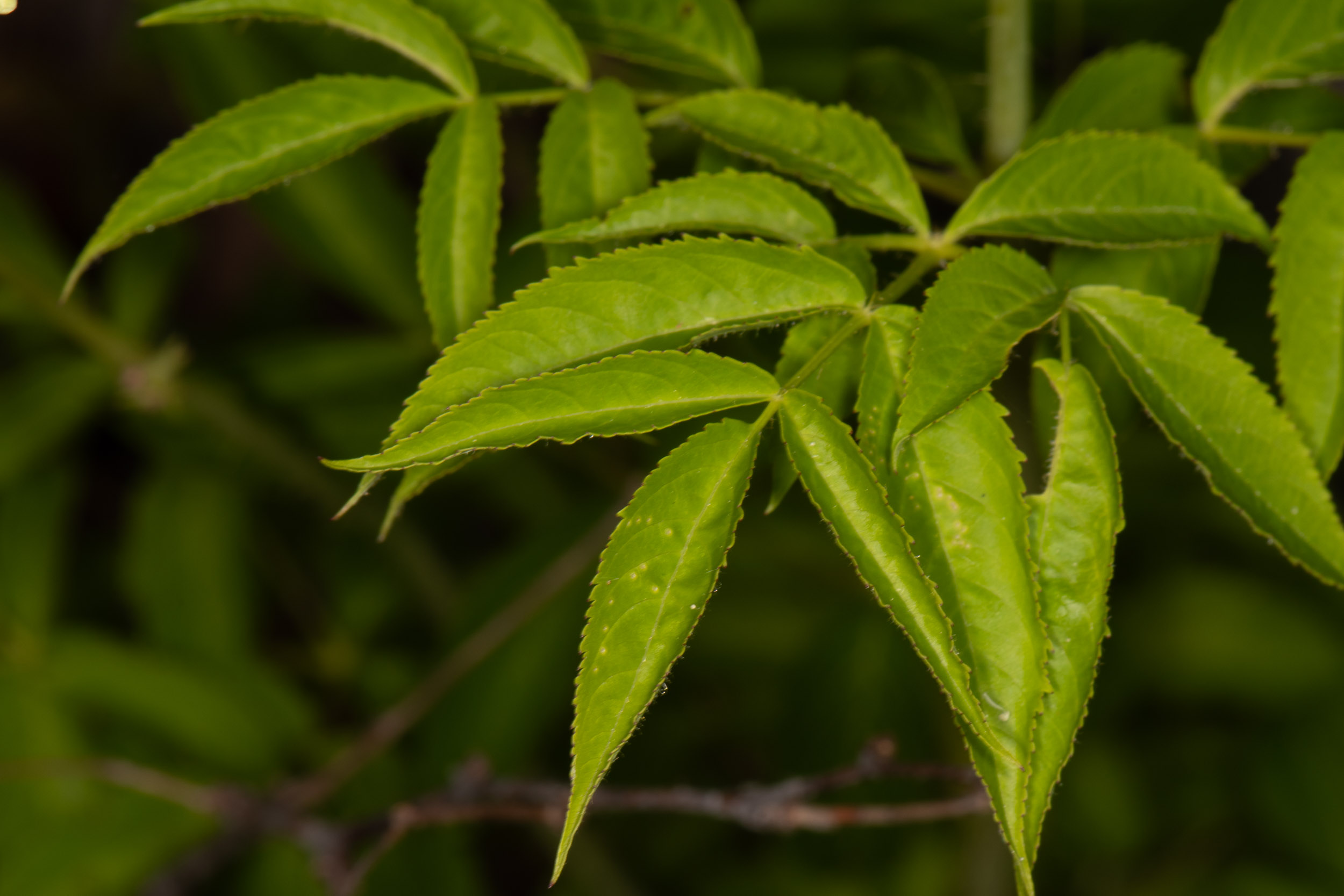
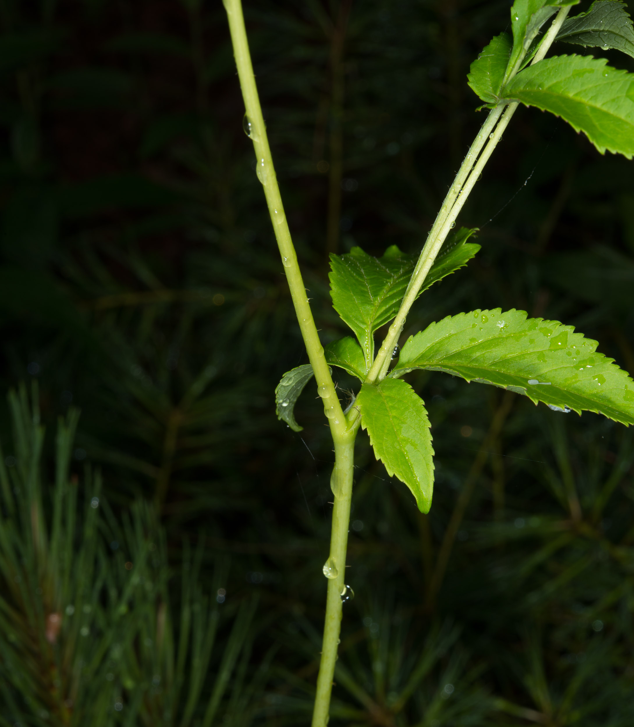
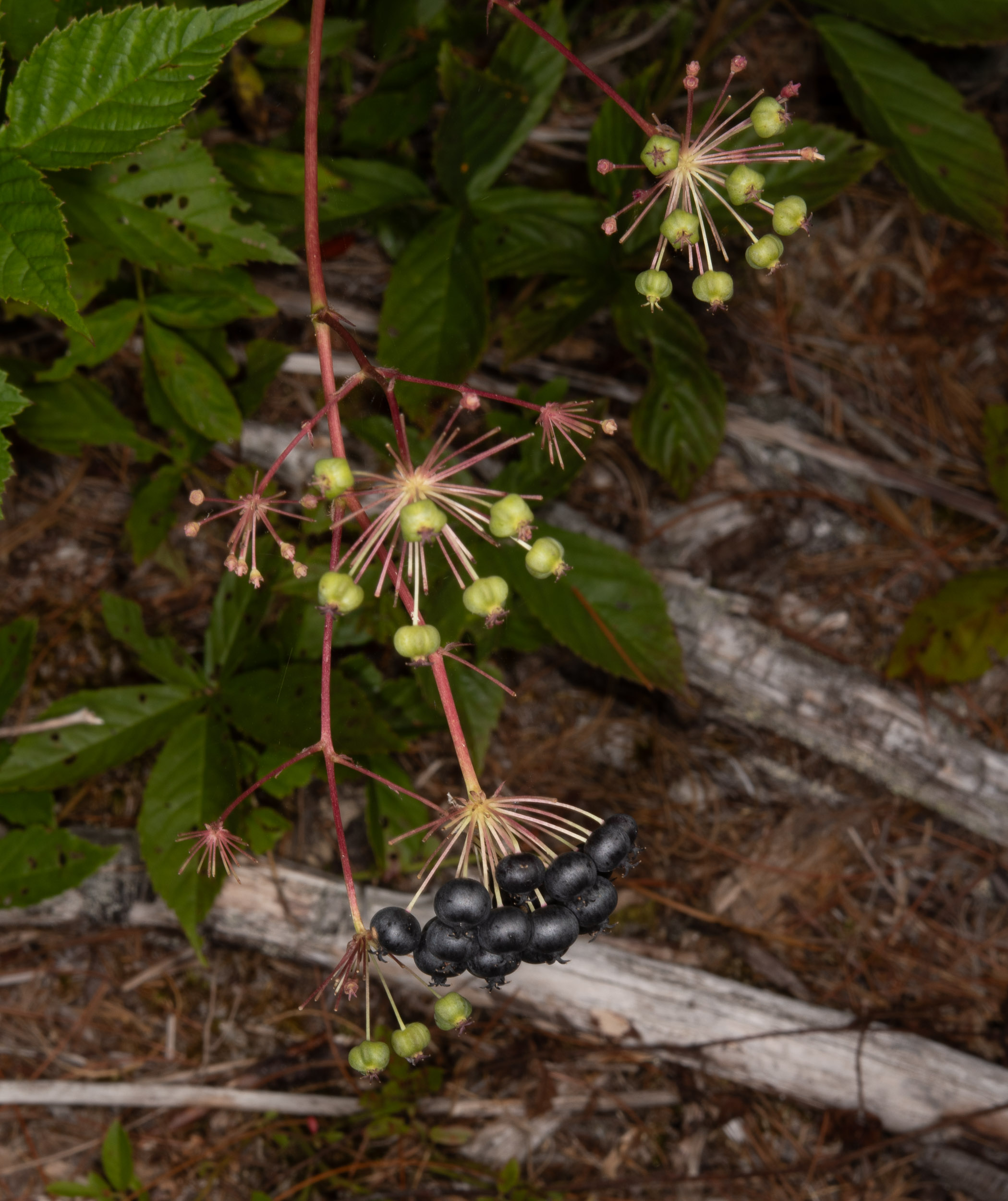
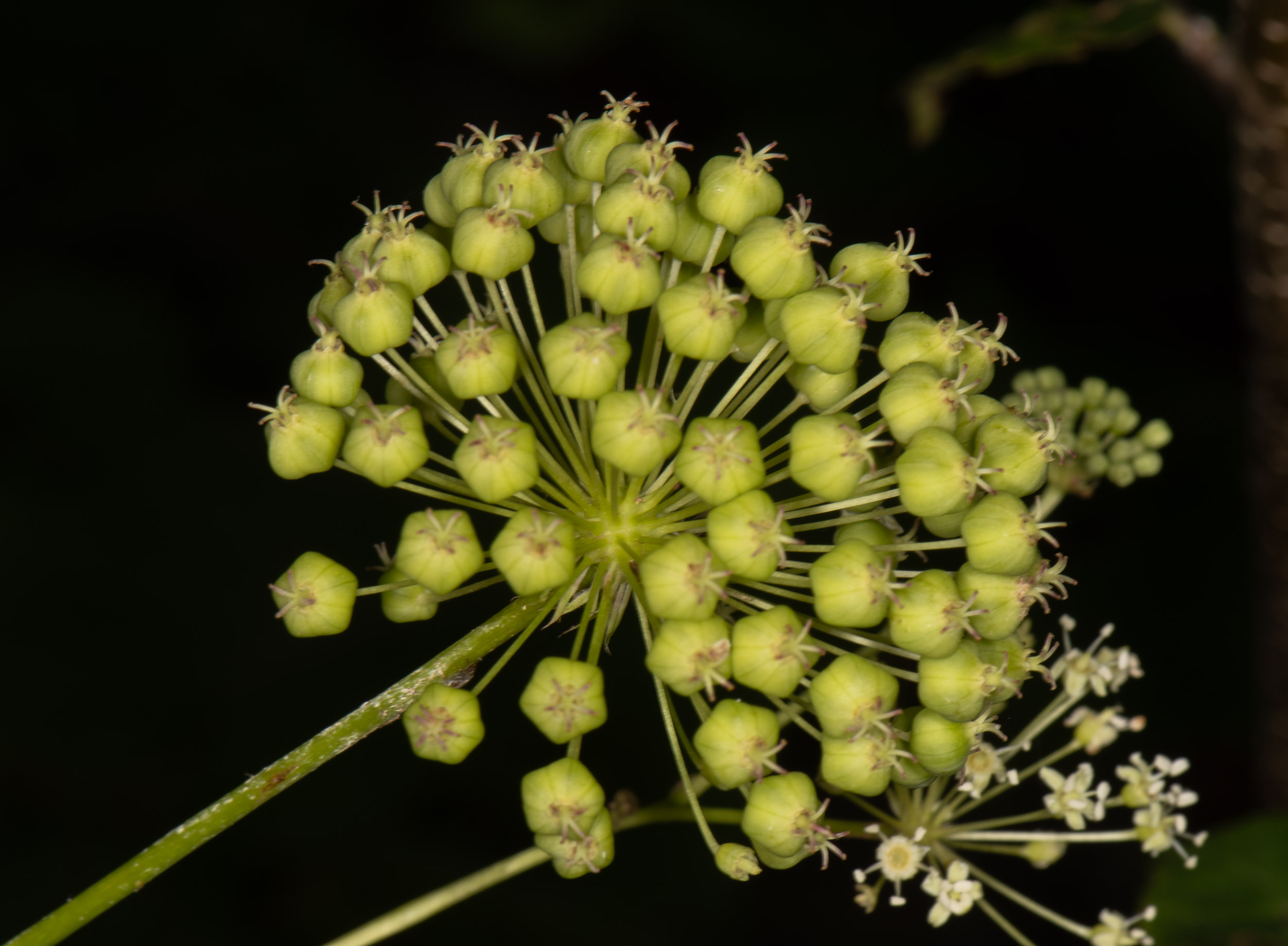
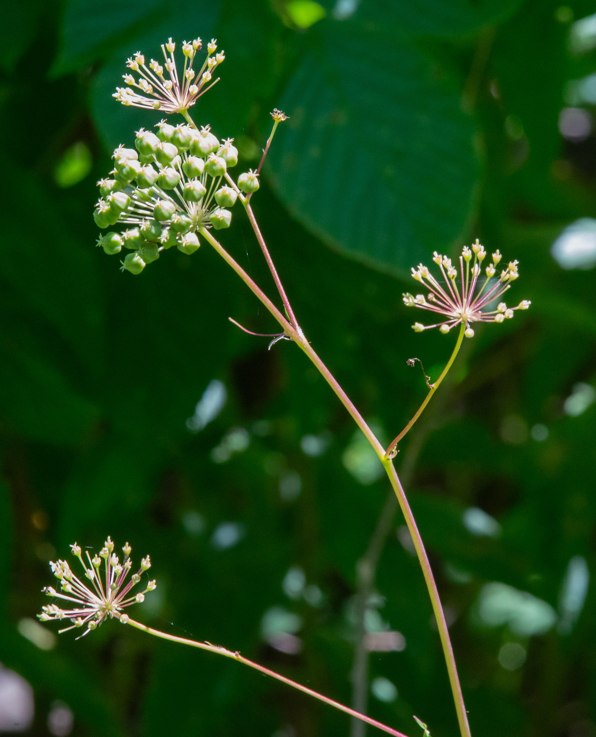
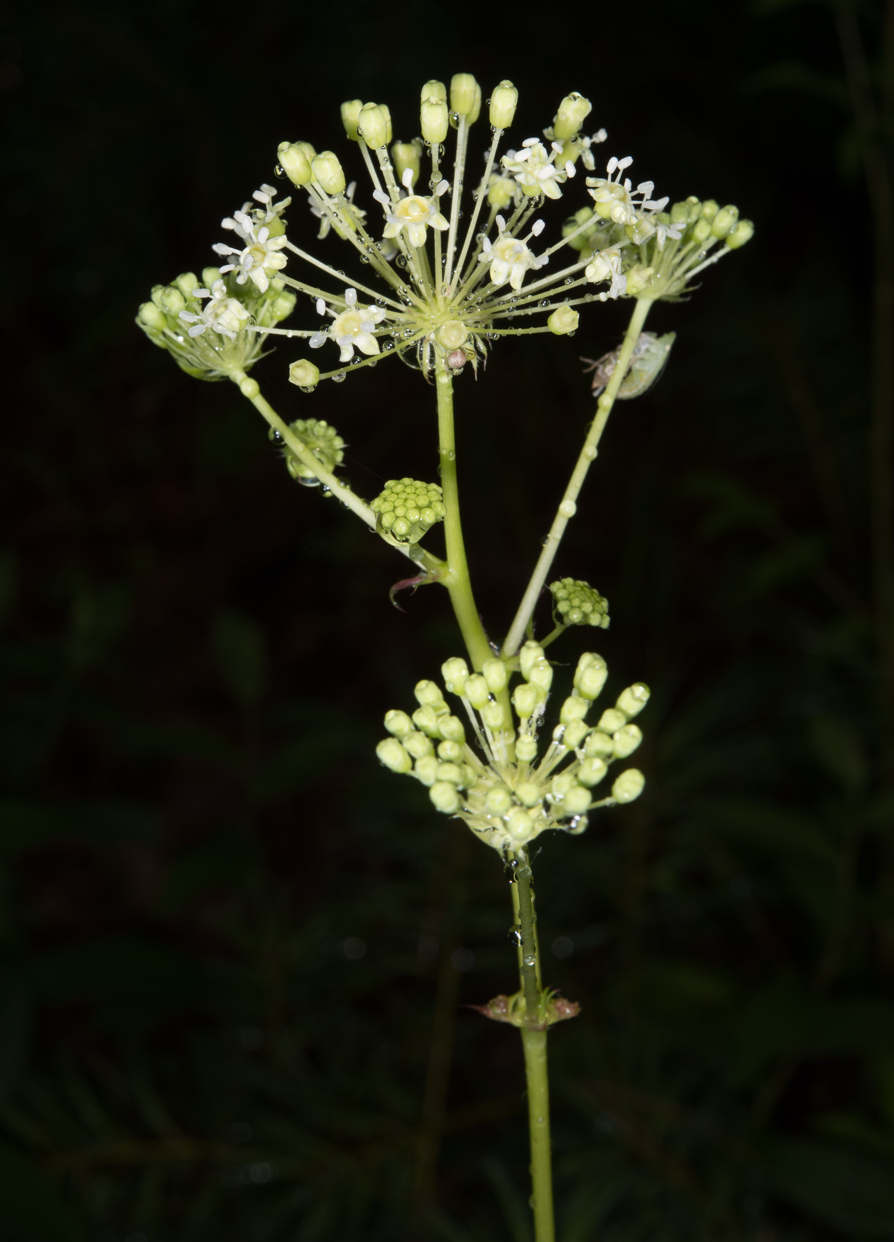
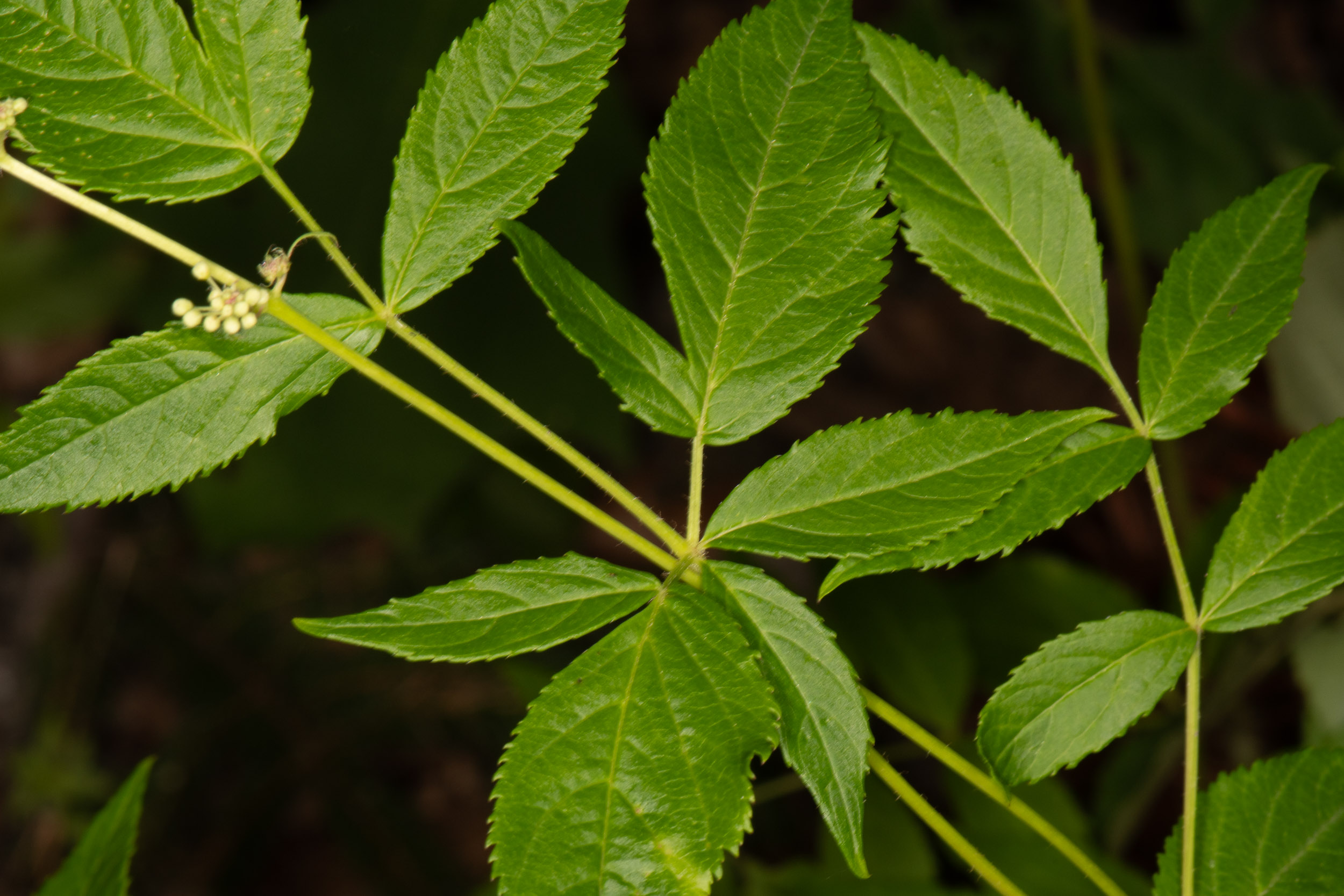
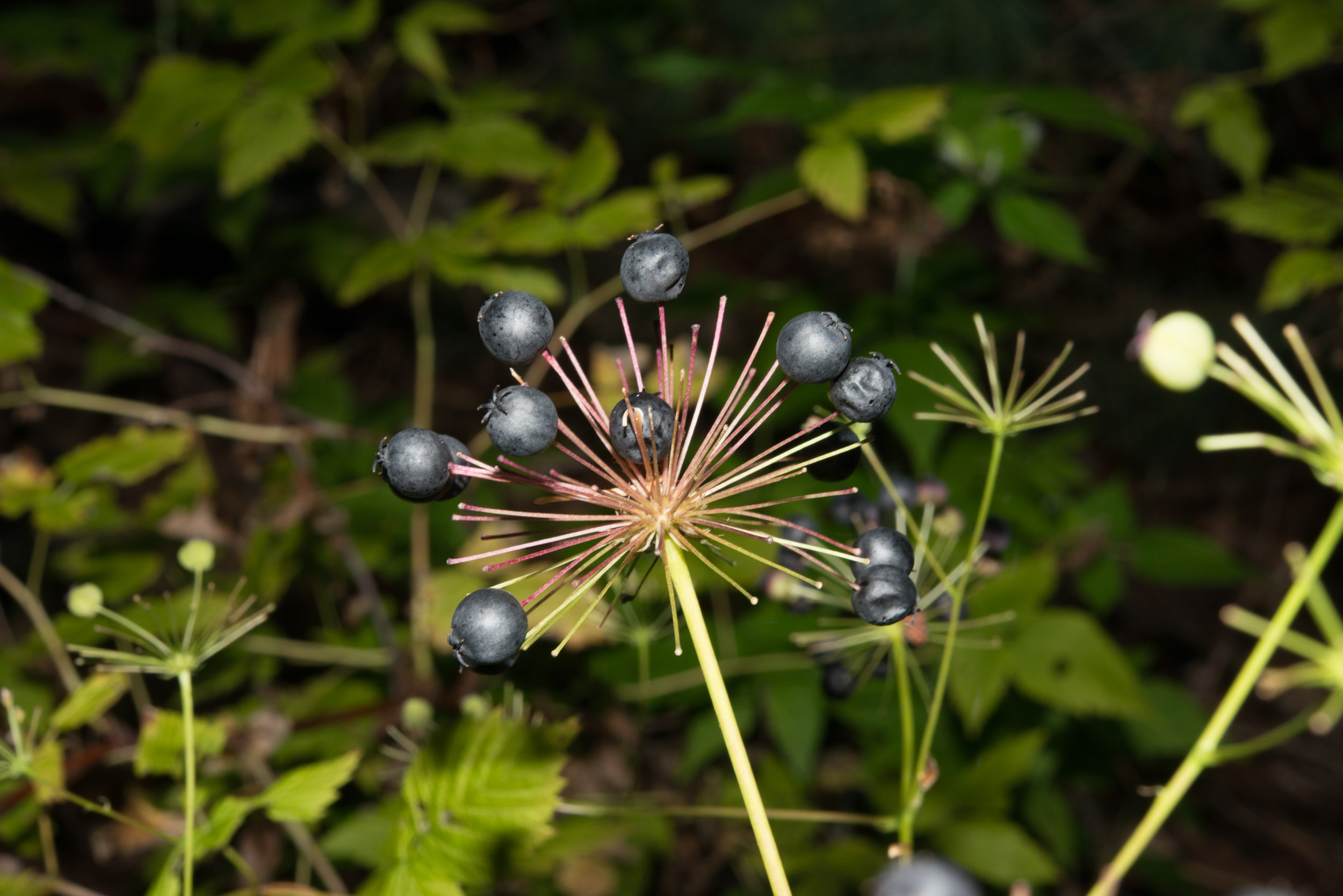
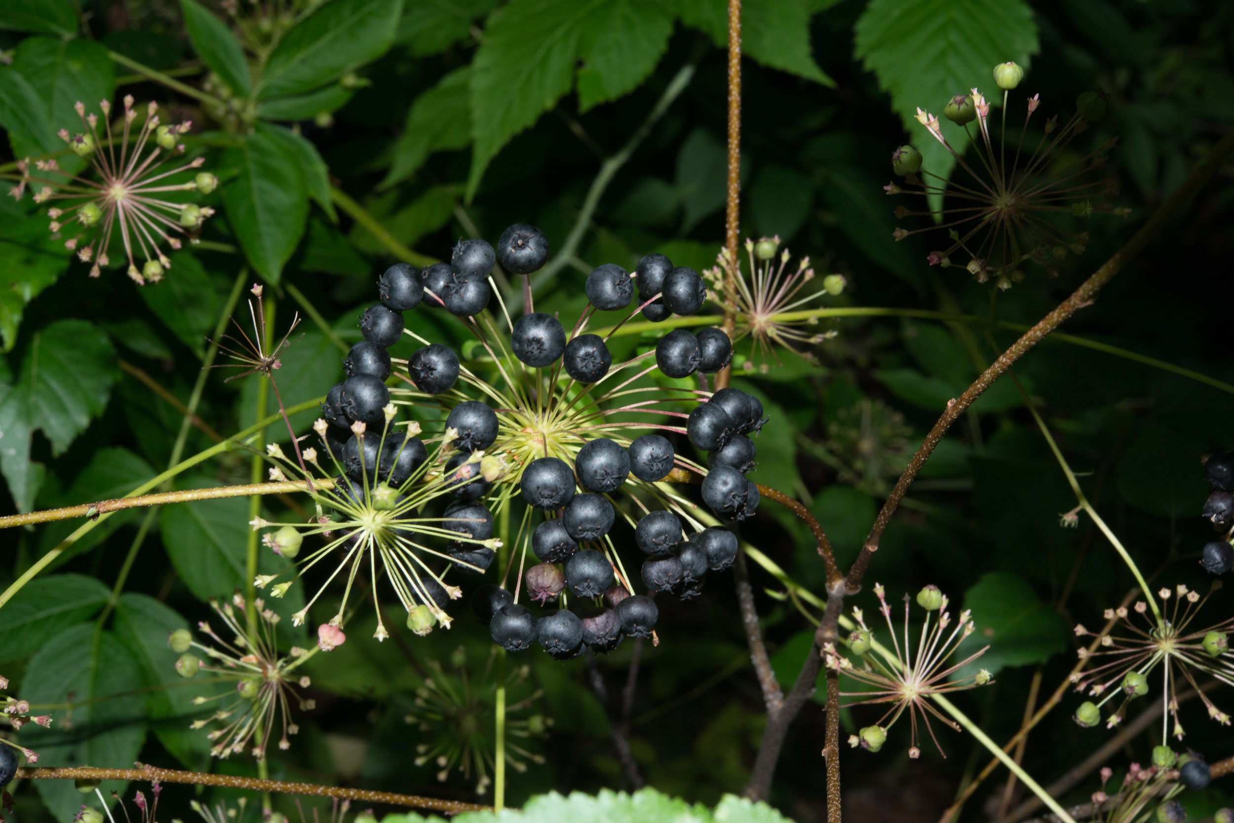
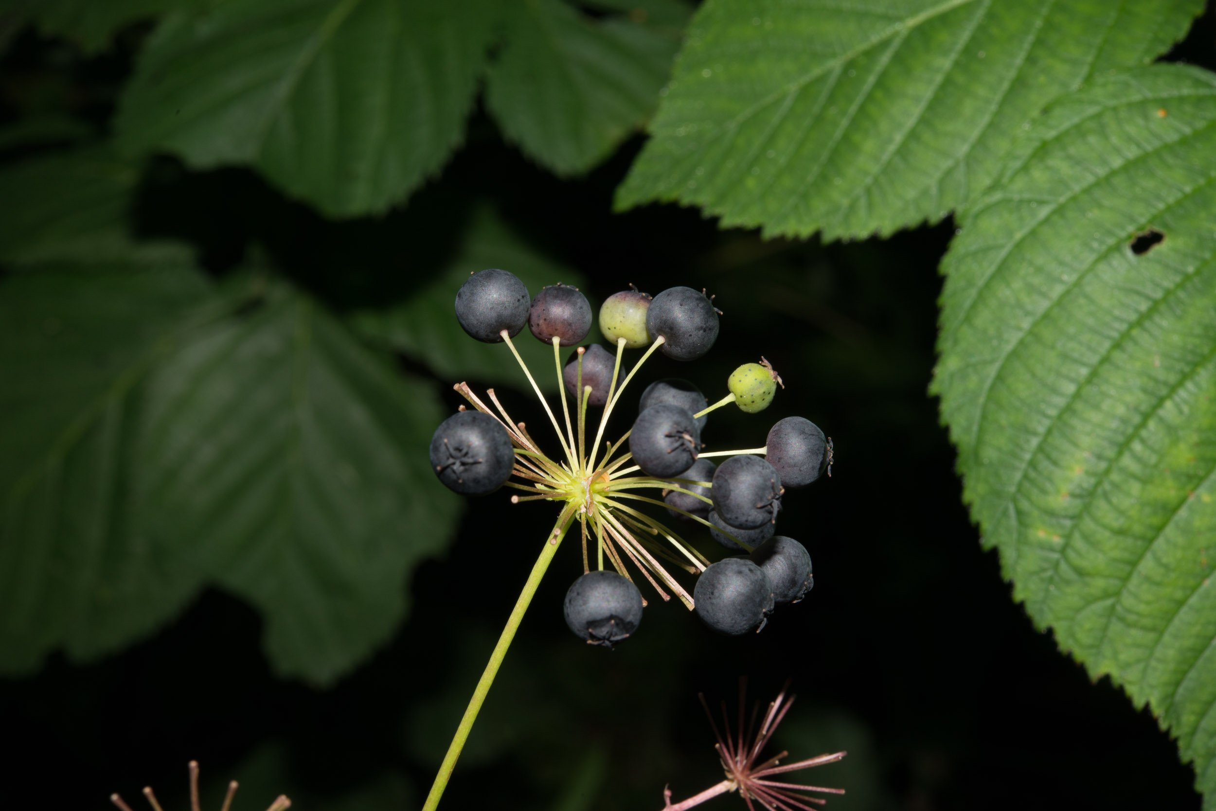
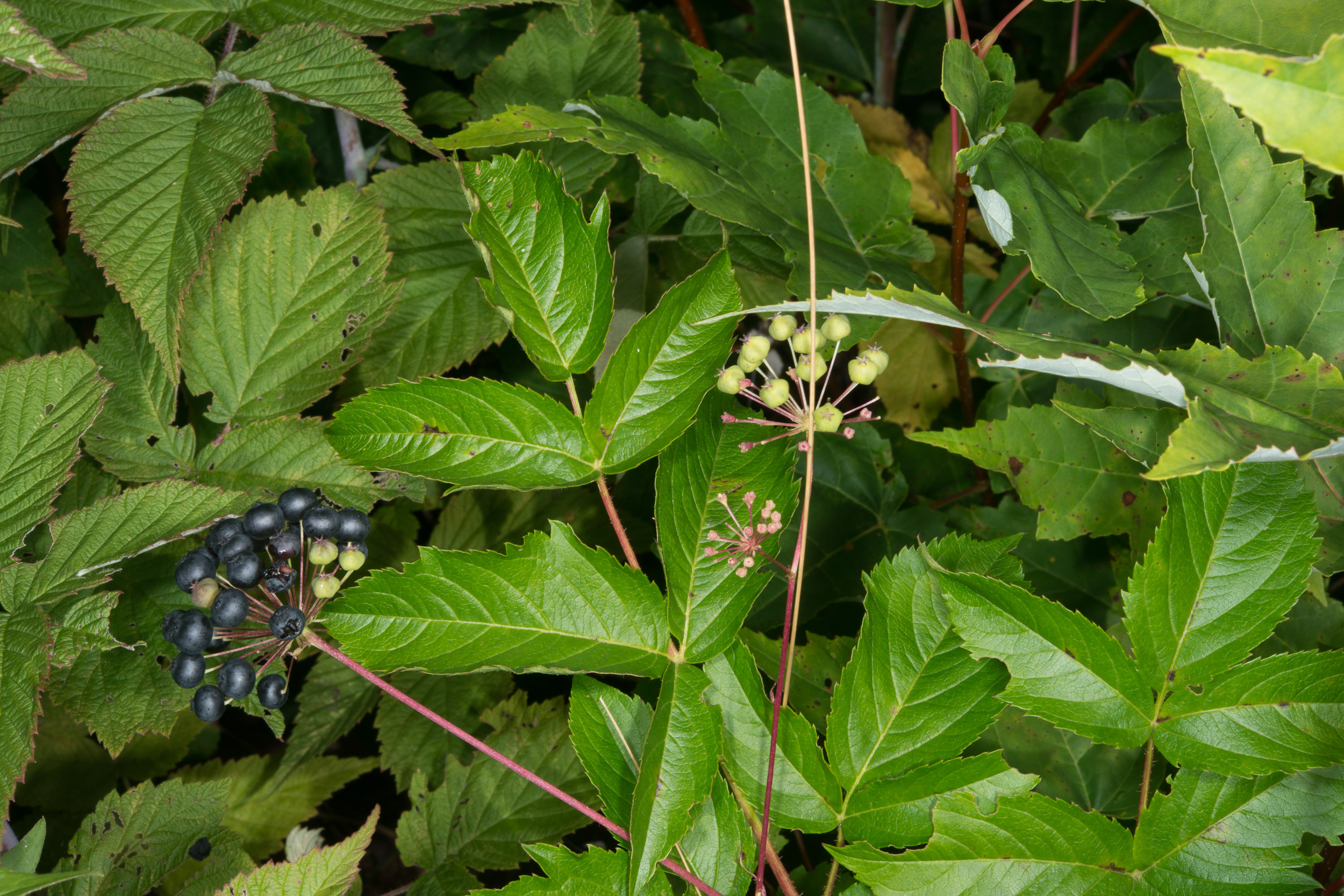
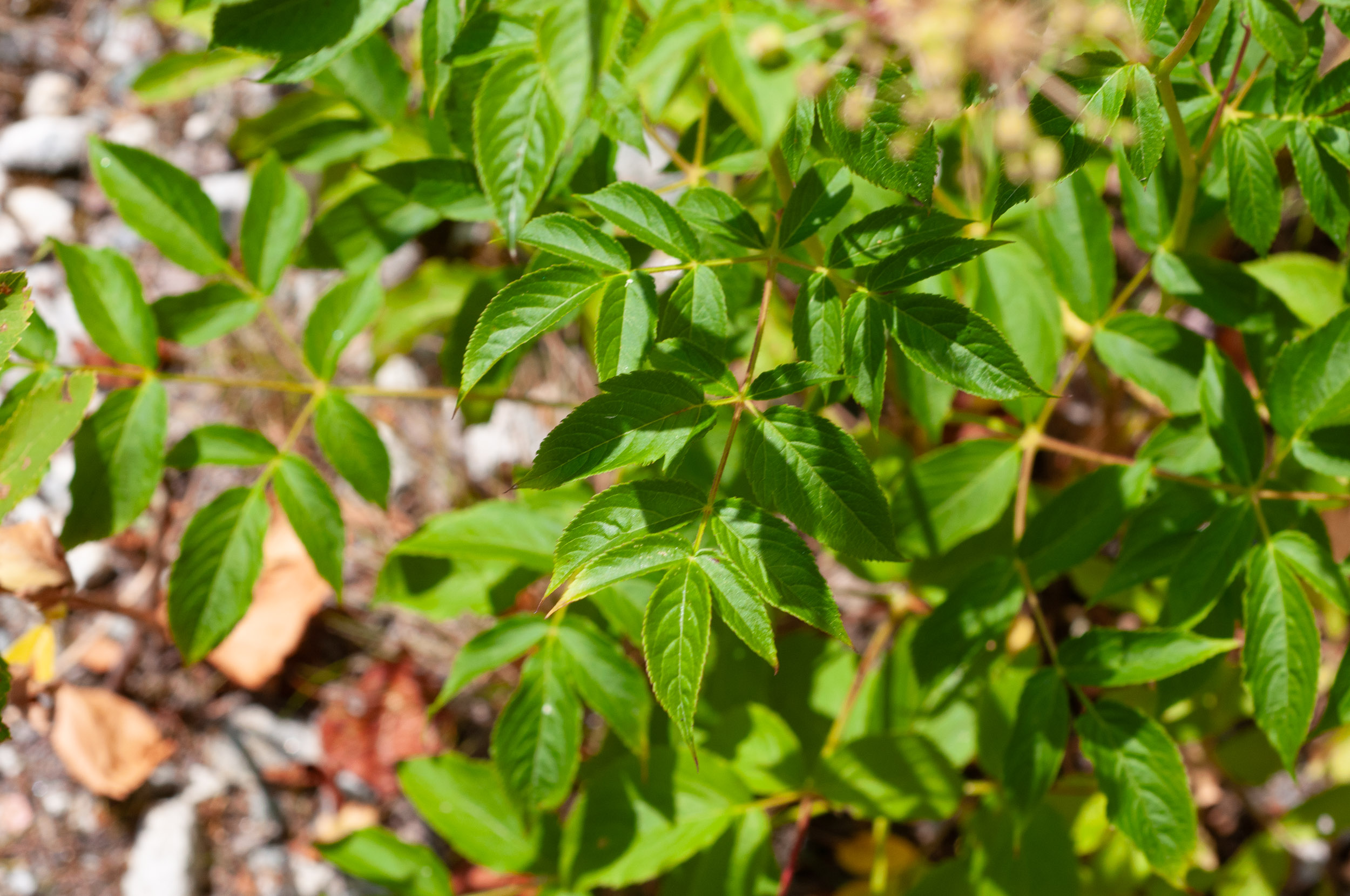
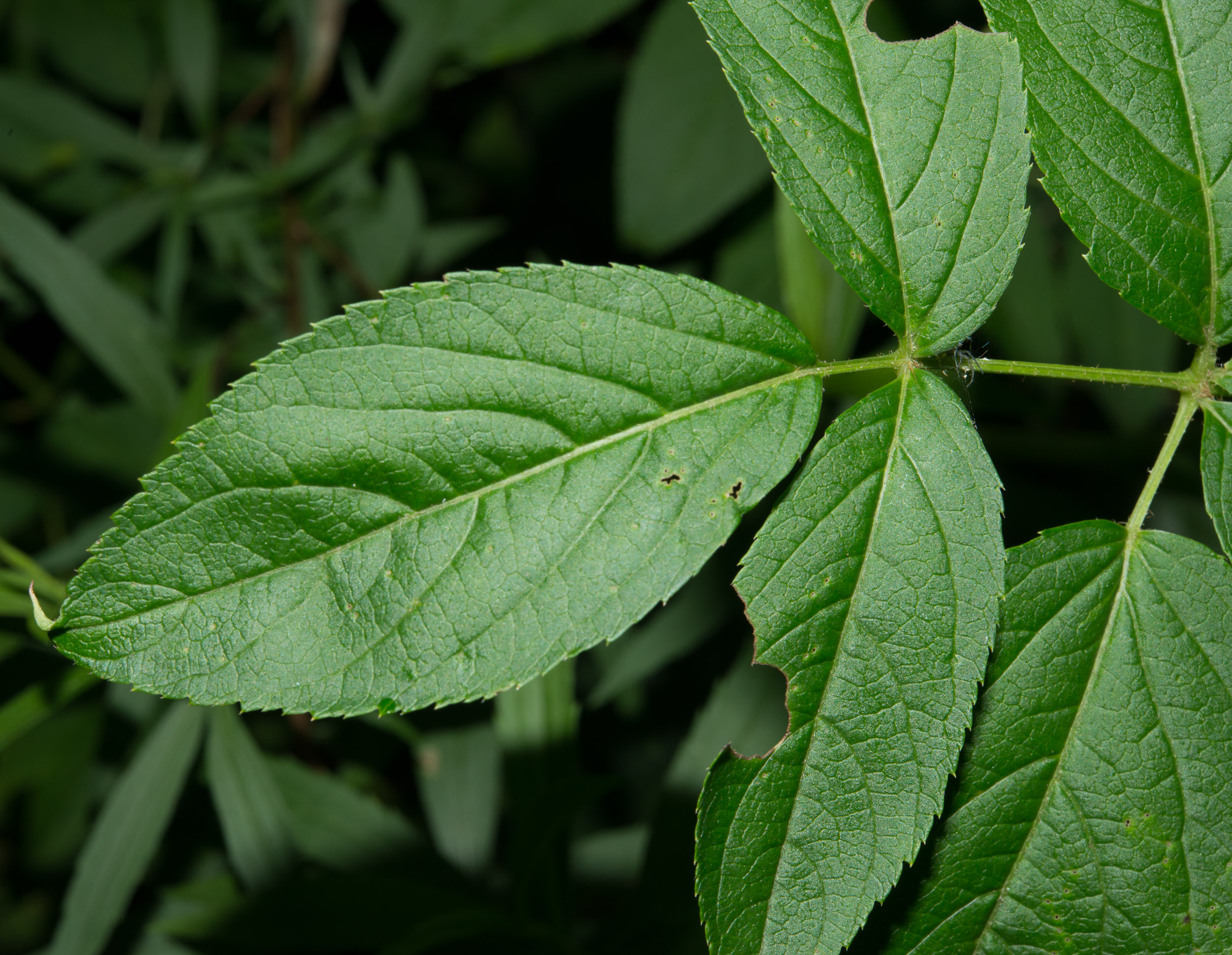
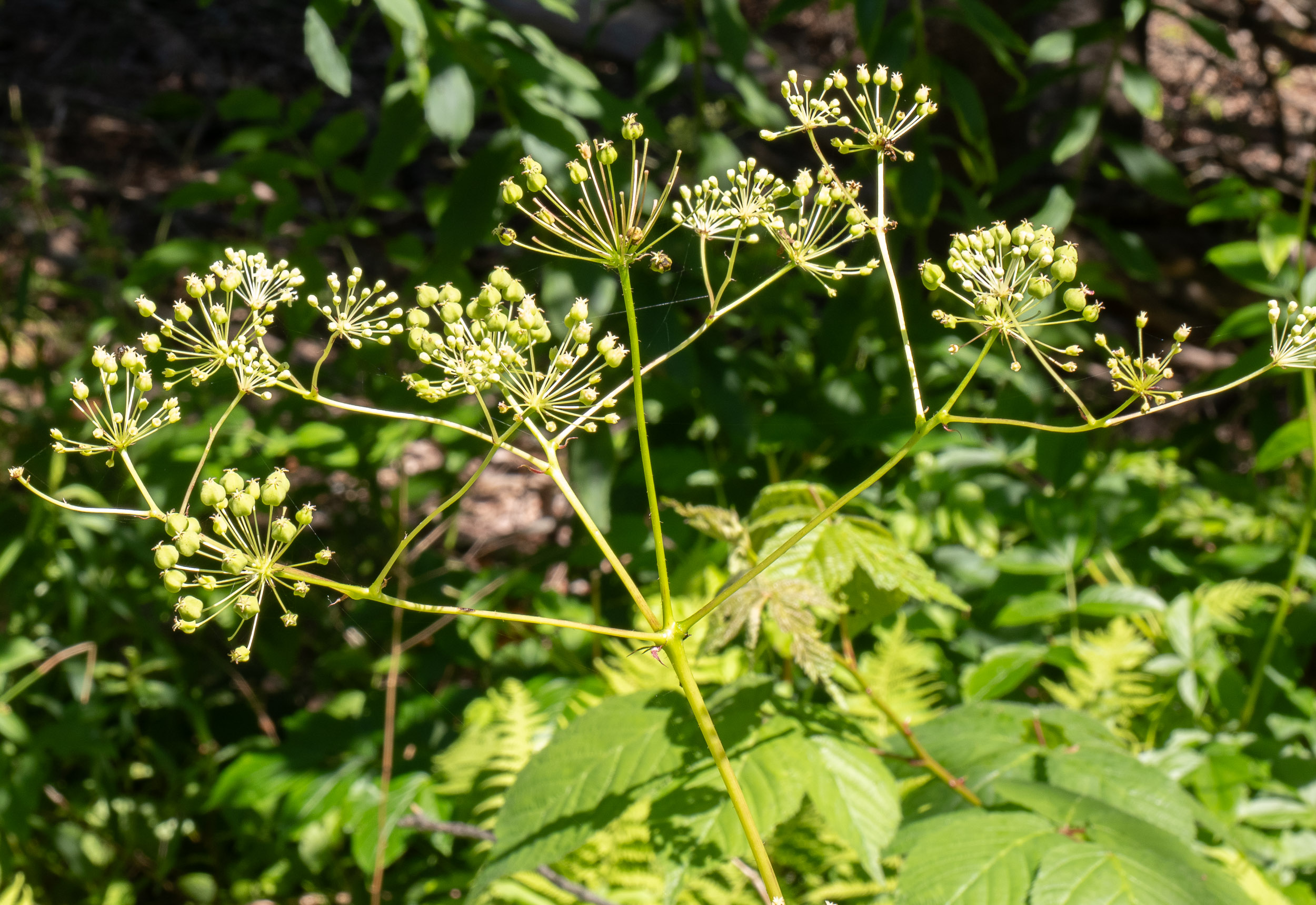
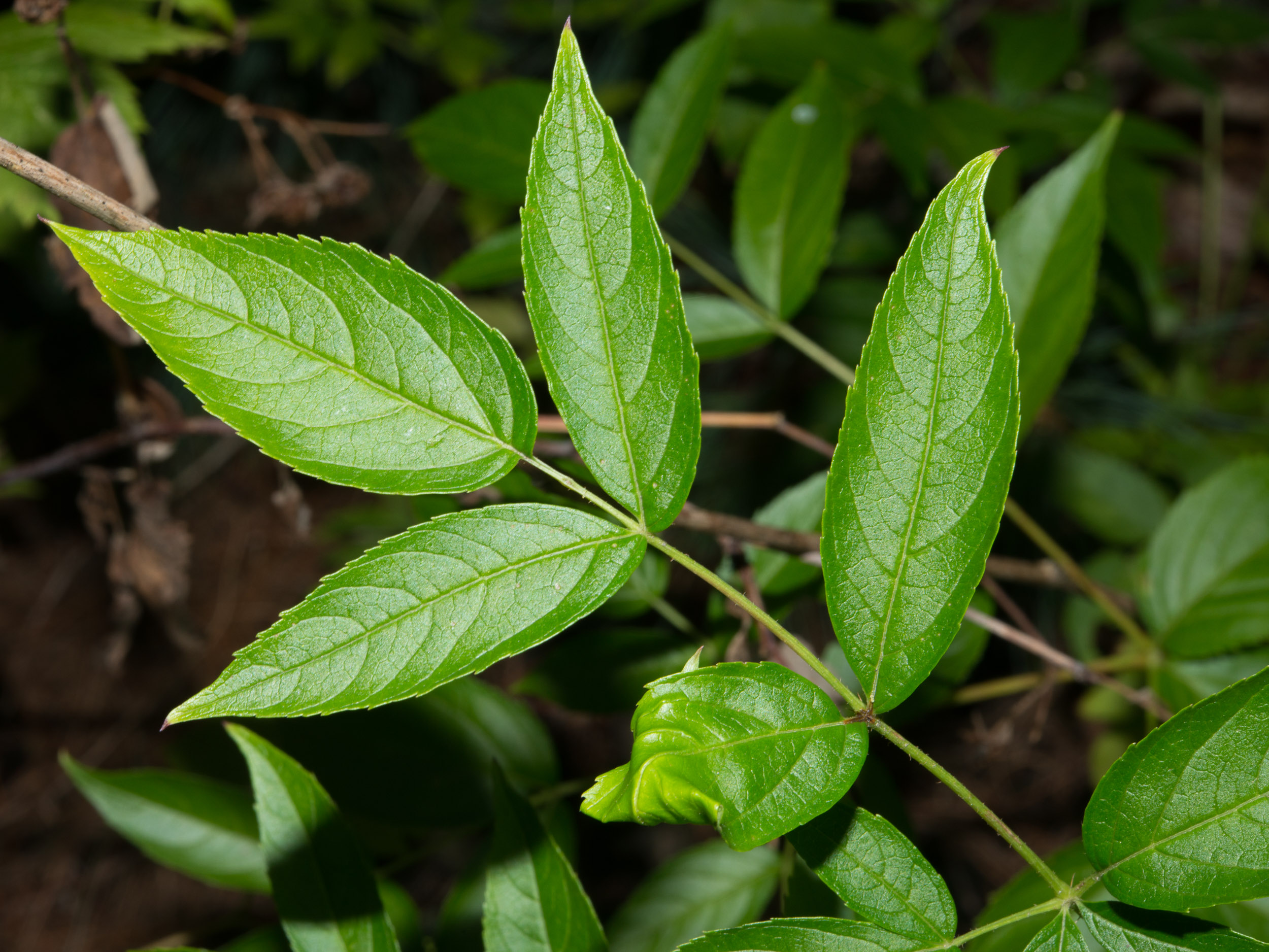
Bristly sarsaparilla is native to eastern North America. The species name, hispida, means "rough," referring to the bristles on the lower stems. Identification: This unpleasant-smelling perennial is 6-30″ (15-76 cm) in height, upright, except when it is bowed under the weight of its copious berries. The lower stems have bristles. Leaves are twice pinnately divided. (Pinnate means "with many opposing pairs of leaves," like the veins of a feather. Bipinnate means "pairs of smaller pairs." Twice pinnately divided means "a pair of pinnate branches." You can see this clearly in Photo 25.) Leaves are clustered on the lower portions of the plants. They are serrated (sharp toothed), oblong to elliptic, up to 3″ (8.3 cm) long. The flowers form umbels, clusters that are almost perfectly round. Each individual flower is on a tiny ½″ (1.3 cm) stem that emerges from a central point, forming delicate spheres of cream-colored or greenish flowers perched atop long stems. Each flower is about ¼″ (6.3 mm) in size, with five petals. They appear in June through September. The flowers become distinctive blue-black berry clusters. Bristly sarsaparilla grows in rocky or sandy soils that are low in nutrients. Wild sarsaparilla is sometimes confused with "real" sarsaparilla, even though the plants bear no resemblance to each other and do not overlap in range. Here are some other possible sources of confusion:
Edibility: Not edible. The berries will make you sick. Online References:
Earl J.S. Rook's Flora, Fauna, Earth, and Sky ... The Natural History of the Northwoods Plants for a Future, a resource and information centre for edible and otherwise useful plants The Lady Bird Johnson Wildflower Center References:
Clemants, Steven; Gracie, Carol, Wildflowers in the Field and Forest, Oxford University Press, 2006, p. 316
1 · 8/16/2014 · White Mountains, New Hampshire · ≈ 10 × 7″ (25 × 16 cm)
2 · 8/10/2013 · Stone Arch Bridge Trail, Near Flat Rock Hill, Dunstable, Massachusetts
3 · 8/17/2020 · Otter Brook Preserve, Harpswell, Maine · ≈ 10 × 6″ (24 × 16 cm)
4 · 8/17/2020 · Otter Brook Preserve, Harpswell, Maine · ≈ 7 × 4½″ (18 × 12 cm)
5 · 7/22/2012 · Wapack Trail, Pack Monadnock, Peterborough, New Hampshire · ≈ 7 × 4½″ (17 × 11 cm)
6 · 8/10/2013 · Stone Arch Bridge Trail, Near Flat Rock Hill, Dunstable, Massachusetts
7 · 9/8/2017 · Bates Land and Blackman Land, Groton Conservation Trust, Groton, Massachusetts · ≈ 6 × 4″ (16 × 11 cm)
8 · 8/10/2013 · Stone Arch Bridge Trail, Near Flat Rock Hill, Dunstable, Massachusetts
9 · 7/5/2021 · Curtis Farm Preserve, Harpswell, Maine · ≈ 5 × 3″ (12 × 8.4 cm)
10 · 9/8/2017 · Bates Land and Blackman Land, Groton Conservation Trust, Groton, Massachusetts · ≈ 4 × 6″ (11 × 16 cm)
11 · 6/22/2021 · Tarbox Preserve, Topsham, Maine · ≈ 4½ × 3″ (11 × 7.5 cm)
12 · 6/26/2014 · J. Harry Rich State Forest, Groton, Massachusetts · ≈ 8 × 5″ (19 × 12 cm)
13 · 6/26/2014 · J. Harry Rich State Forest, Groton, Massachusetts · ≈ 8 × 5″ (19 × 12 cm)
Aralia hispida description by Thomas H. Kent, last updated 26 Jul 2023.
© FloraFinder.org. All rights reserved. |
14 · 6/22/2021 · Tarbox Preserve, Topsham, Maine · ≈ 4½ × 3″ (11 × 7.9 cm)
15 · 8/16/2014 · White Mountains, New Hampshire · ≈ 9 × 6″ (23 × 16 cm)
16 · 6/26/2014 · J. Harry Rich State Forest, Groton, Massachusetts · ≈ 5 × 8″ (12 × 19 cm)
17 · 8/17/2020 · Otter Brook Preserve, Harpswell, Maine · ≈ 5 × 8″ (13 × 20 cm)
18 · 7/5/2021 · Curtis Farm Preserve, Harpswell, Maine · ≈ 6 × 3½″ (14 × 9.4 cm)
19 · 7/31/2021 · Otter Brook Preserve, Harpswell, Maine
20 · 6/26/2014 · J. Harry Rich State Forest, Groton, Massachusetts · ≈ 5 × 8″ (12 × 19 cm)
21 · 7/5/2021 · Curtis Farm Preserve, Harpswell, Maine · ≈ 7 × 4½″ (16 × 11 cm)
22 · 8/10/2013 · Stone Arch Bridge Trail, Near Flat Rock Hill, Dunstable, Massachusetts
23 · 8/10/2013 · Stone Arch Bridge Trail, Near Flat Rock Hill, Dunstable, Massachusetts
24 · 8/10/2013 · Stone Arch Bridge Trail, Near Flat Rock Hill, Dunstable, Massachusetts
25 · 8/10/2013 · Stone Arch Bridge Trail, Near Flat Rock Hill, Dunstable, Massachusetts
26 · 8/16/2014 · White Mountains, New Hampshire · ≈ 12 × 8″ (31 × 21 cm)
27 · 7/22/2012 · Wapack Trail, Pack Monadnock, Peterborough, New Hampshire · ≈ 9 × 6″ (23 × 15 cm)
28 · 8/10/2013 · Stone Arch Bridge Trail, Near Flat Rock Hill, Dunstable, Massachusetts
29 · 7/20/2023 · Curtis Farm Preserve, Harpswell, Maine
30 · 8/10/2013 · Stone Arch Bridge Trail, Near Flat Rock Hill, Dunstable, Massachusetts Range:
|